In cooperation between the University of Tartu, the Estonian University of Life Sciences, and the Centre of Estonian Rural Research and Knowledge, a two-year research and development project titled “Land Use Management Platform” was launched in May 2026. The aim of the project is to develop a comprehensive, science-based land use decision-support prototype based on spatial data, helping to balance the needs of nature conservation, climate goals, and economic development.
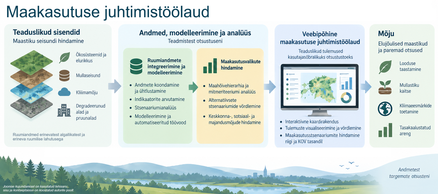
As a result of the project, an interactive web-based platform will be created to support better-informed spatial decisions, taking into account biodiversity, soil conditions, climate impacts, development pressure, and local development needs simultaneously.
Currently, many important environmental and planning datasets exist, but they are located in separate systems and cannot be used effectively and comprehensively in land-use decision-making. As a result, it is difficult to compare alternative development pathways or assess the long-term impacts of decisions on nature, climate goals, and local development. The project will provide a solution that integrates existing spatial data into a unified automated analysis and visualization environment.
The methodology is based on developing indicators related to ecosystem and soil condition as well as climate metrics, and integrating them into a unified spatial data cube where multidimensional indices and scenarios are calculated. Alternative land-use scenarios are evaluated using multi-criteria analysis, and the results are presented in an interactive web-based decision-support tool.
The developed tool will enable:
- assessment of the impacts of different land-use decisions on biodiversity, soil condition, and carbon sequestration at both local government and state levels;
- comparison of alternative development and restoration scenarios;
- identification of areas where conservation, restoration, or development would yield the greatest environmental and societal benefits;
- directing development activities to already degraded areas;
- evaluation of the suitability of degraded and brownfield sites for industry, renewable energy, or other types of development;
- support for the preparation of spatial plans and development documents.
Stakeholders play a key role in the development of the management platform, especially those related to land-use decision-making, from government authorities to local land users. The closest cooperation takes place with the Ministry of Climate, the Ministry of Economic Affairs and Communications, and the Ministry of Regional Affairs and Agriculture, as well as authorities within their administrative areas. To effectively integrate the needs and feedback of local governments, pilot municipalities – Tartu, Lüganuse, and Lääneranna – have been involved in direct cooperation. The private and third sectors, including civil society organizations, are also continuously engaged in the process.
The project directly supports the goals of Estonia and the European Union in the domains of nature restoration, climate policy, soil protection, and sustainable spatial development, and helps reduce land-use conflicts through a more transparent and science-based decision-making process.
The project is implemented under the RITA+ programme (“Increasing the capacity of society to implement research, development, and innovation results and creating a supportive policy environment”), within the sub-activity “Commissioning interdisciplinary applied research to address challenges of Estonian society or economy.” The project is commissioned by the Estonian Research Council and the Ministry of Climate. It is co-funded by the European Union.